


VTD-precinct 5, Douglas County, South Dakota
About
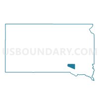
Outline

Summary
| Unique Area Identifier | 667270 |
| Name | VTD-precinct 5 |
| County | Douglas County |
| State | South Dakota |
| Area (square miles) | 203.13 |
| Land Area (square miles) | 202.41 |
| Water Area (square miles) | 0.73 |
| % of Land Area | 99.64 |
| % of Water Area | 0.36 |
| Latitude of the Internal Point | 43.40275190 |
| Longtitude of the Internal Point | -98.29393910 |
Maps


Graphs
Select a template below for downloading or customizing gragh for VTD-precinct 5, Douglas County, South Dakota


Neighbors
Neighoring Voting District (by Name) Neighboring Voting District on the Map
- VTD - county precinct 2 - Baker, Union, Mt Vernon Twnships & Mt Vernon city, Davison County, SD
- VTD - county precinct 4 - Rome & Tobin twnships & Ethan town, Davison County, SD
- VTD precinct 1, Charles Mix County, SD
- VTD precinct 4, Hutchinson County, SD
- VTD precinct 5, Charles Mix County, SD
- VTD precinct 6, Hutchinson County, SD
- VTD precinct 8, Charles Mix County, SD
- VTD-precinct 1, Aurora County, SD
- VTD-precinct 1, Douglas County, SD
- VTD-precinct 2, Douglas County, SD
- VTD-precinct 3, Douglas County, SD
- VTD-precinct 3 ArmourTown-ward2, Douglas County, SD
- VTD-precinct 4 ArmourTown, Douglas County, SD
Top 10 Neighboring County Subdivision (by Population) Neighboring County Subdivision on the Map
- Armour city, Douglas County, SD (699)
- Corsica city, Douglas County, SD (592)
- Howard township, Charles Mix County, SD (273)
- Susquehanna township, Hutchinson County, SD (181)
- Holland township, Douglas County, SD (156)
- Washington township, Douglas County, SD (131)
- Starr township, Hutchinson County, SD (127)
- Valley township, Douglas County, SD (126)
- Tobin township, Davison County, SD (125)
- Independence township, Douglas County, SD (119)
Top 10 Neighboring Place (by Population) Neighboring Place on the Map
Top 10 Neighboring Unified School District (by Population) Neighboring Unified School District on the Map
- Platte-Geddes School District 11-5, SD (3,157)
- Parkston School District 33-3, SD (2,950)
- Andes Central School District 11-1, SD (2,242)
- Tripp-Delmont School District 33-5, SD (1,540)
- Corsica School District 21-2, SD (1,241)
- Armour School District 21-1, SD (1,054)
- Mount Vernon School District 17-3, SD (998)
- Ethan School District 17-1, SD (788)
- Stickney School District 01-2, SD (729)
Top 10 Neighboring State Legislative District Lower Chamber (by Population) Neighboring State Legislative District Lower Chamber on the Map
- State House District 20, SD (22,214)
- State House District 21, SD (21,057)
- State House District 19, SD (19,075)
Top 10 Neighboring State Legislative District Upper Chamber (by Population) Neighboring State Legislative District Upper Chamber on the Map
- State Senate District 20, SD (22,214)
- State Senate District 21, SD (21,057)
- State Senate District 19, SD (19,075)
Top 10 Neighboring 111th Congressional District (by Population) Neighboring 111th Congressional District on the Map
Top 10 Neighboring Census Tract (by Population) Neighboring Census Tract on the Map
- Census Tract 9403, Charles Mix County, SD (3,323)
- Census Tract 9402, Charles Mix County, SD (3,142)
- Census Tract 9696, Douglas County, SD (3,002)
- Census Tract 9626, Davison County, SD (2,919)
- Census Tract 9736, Aurora County, SD (2,710)
- Census Tract 9687, Hutchinson County, SD (2,276)
- Census Tract 9688, Hutchinson County, SD (1,914)
Top 10 Neighboring 5-Digit ZIP Code Tabulation Area (by Population) Neighboring 5-Digit ZIP Code Tabulation Area on the Map
- 57366, SD (2,228)
- 57328, SD (1,134)
- 57313, SD (1,128)
- 57363, SD (1,003)
- 57334, SD (895)
- 57375, SD (647)
- 57330, SD (625)
- 57342, SD (558)
- 57331, SD (459)